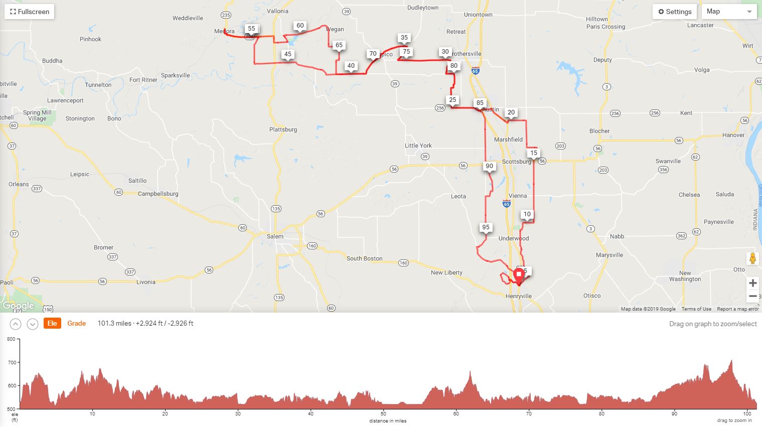
This version of the Medora Century has been revised to route around road construction.
This is the version used for the TMD Century scheduled 10/12/2019.
Medora
Century (Revised) |
||
Mile |
Turn |
Road |
0.0 |
L |
out of parking heading into forestry |
0.6 |
L |
First Road after X I-65 |
0.7 |
L |
N. Franke at T |
2.0 |
R |
at T toward park entrance |
2.3 |
R |
at T toward park entrance |
4.3 |
L |
State Road 31 |
4.4 |
R |
Hebron Road |
5.4 |
L |
Old State Road |
7.5 |
R |
Beagle Club |
7.5 |
L |
Hall's Corner |
8.5 |
S |
Underwood Road |
9.7 |
R |
Radio Tower Road |
10.5 |
L |
Double or Nothing Road |
15.0 |
X |
St. Rd. 56 to Slate Cut Road |
16.1 |
L |
Grain Bin Road |
16.9 |
R |
Slab Road |
18.9 |
L |
Cutshall Road |
20.2 |
L |
Coffee Pot Curve |
20.4 |
R |
State Road 31 CAUTION: BUSY |
22.1 |
Store Stop: Casey's. Go left on Main/St. Rd. 256 out of store |
|
25.1 |
R |
S. County Rd. 950 E |
26.6 |
R |
E. County Rd. 800 S |
26.8 |
L |
975 S. |
27.8 |
L |
E. County Road 700 S |
28.5 |
R |
Vernon Road (Becomes 950 E) |
29.6 |
L |
E. County Road 600 S |
33.5 |
R |
Dudleytown Spur |
34.8 |
L |
E. 500 S. becomes 540 S |
36.6 |
L |
S. 450 E. |
38.9 |
R |
700 S. |
47.3 |
R |
S. 500 W |
49.3 |
L |
St. Road 235/Washington Street |
51.9 |
R |
to continue on 235 to festival. |
52.6 |
Lunch Stop. Leave festival the way you came in. |
|
52.9 |
L |
St. Road 235 |
56.3 |
R |
St. Road 135 S |
57.7 |
L |
450 S |
58.3 |
L |
275 W/ Lake Road |
58.8 |
R |
Starved Holler/400 S |
63.2 |
L |
E. 500 S |
64 |
R |
S. 125 E |
65 |
R |
E. 600 S |
66.3 |
L |
E. 700 S/Tampico Pike |
68 |
L |
325 E/Tampico Pike |
70.8 |
R |
540 S |
72.4 |
BR |
500 S |
72.6 |
R |
Dudley Spur |
73.8 |
L |
600 S |
77.8 |
R |
950 S/Vernon |
78.9 |
L |
700 S |
79.5 |
R |
975 E |
80.6 |
R |
800 S |
80.8 |
L |
950 E |
82.3 |
L |
State Road 256 |
84.3 |
R |
Dowling Street. Store Stop at Gas Station |
84.3 |
L |
Boatman Road |
88.8 |
L |
S. Taylor Mill |
90.7 |
R |
Rosewood |
91.5 |
L |
Boatman Road |
95.7 |
L |
Bloomington Trail/Brownstown Road |
100.3 |
R |
State Road 31 |
100.8 |
R |
Into Forestry |
Printer-Friendly Cue Sheet (PDF Format)
Interact with map or Download GPS File